Puget Sound Shoreline Mapping Project
Brought to you by Washington Department of Ecology, Earthviews Conservations Society, and EarthViews.com
Explore Featured Areas by clicking on the titles below or the blue lines in the map above.
South Sound
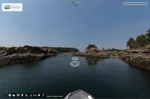
Capitol Lake Dam
Capitol Lake Dam
This man-made barrier that controls the flow of water from the Deschutes River into Capitol Lake is often a topic of environmental discussion due to its impact on local ecosystems.
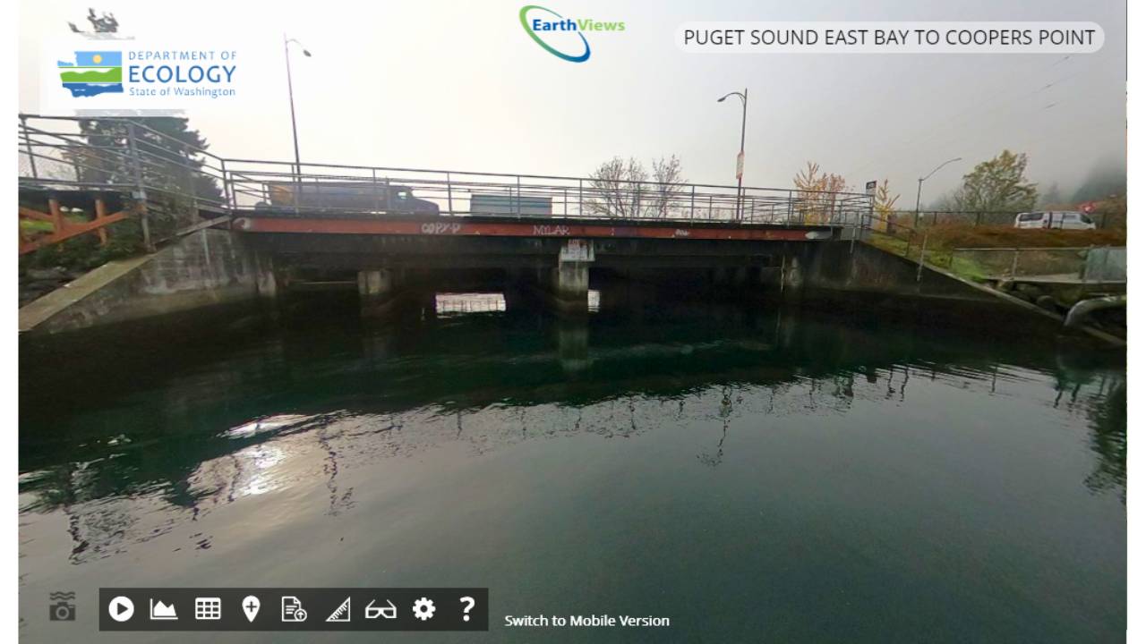
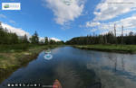
Fisherman's Cove
Fisherman's Cove
A quaint and picturesque spot popular among anglers and boaters, Fisherman's Cove provides a peaceful setting for fishing and relaxation.
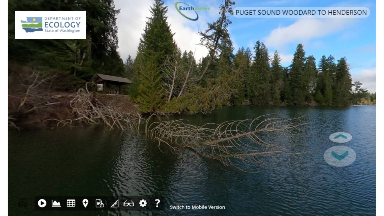
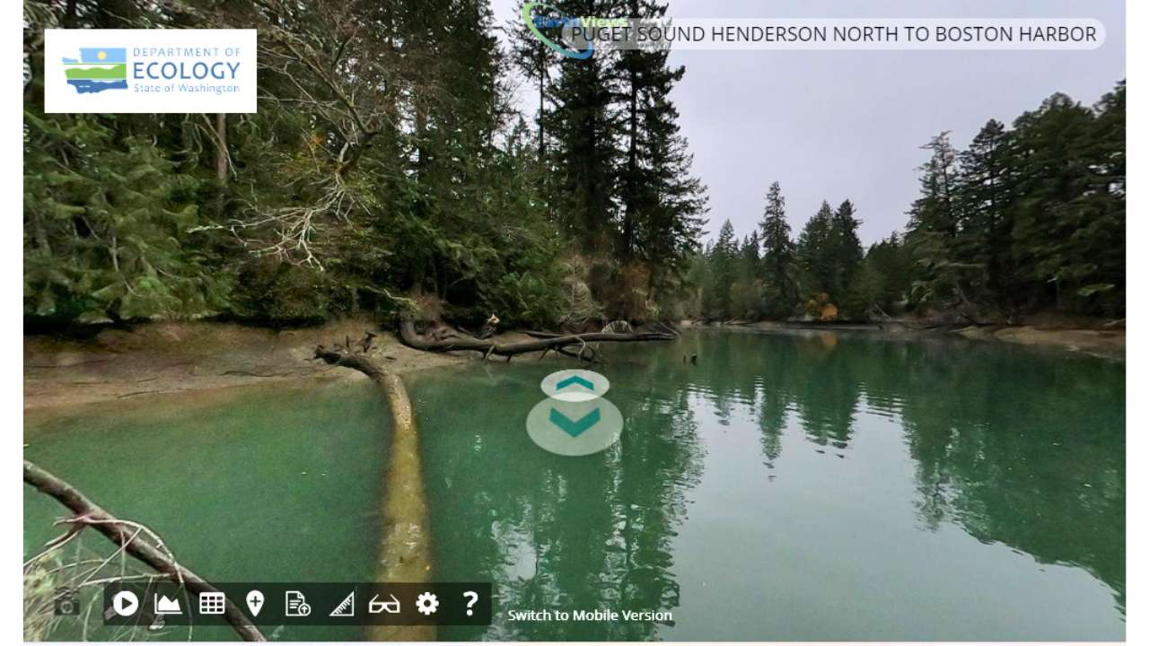
Woodard Bay Natural Area
Woodard Bay Natural Area
A conservation area known for its rich wildlife habitat, offering serene views and a haven for birdwatchers and nature enthusiasts along the Puget Sound shoreline.
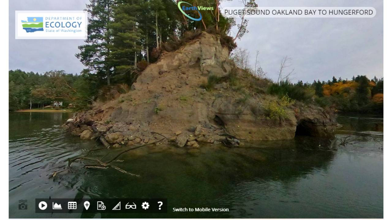
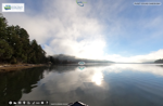
Hammersley Inlet
Hammersley Inlet
This inlet is a narrow waterway that snakes through the landscape, providing a unique boating experience and vistas of the surrounding forests and cliffs.
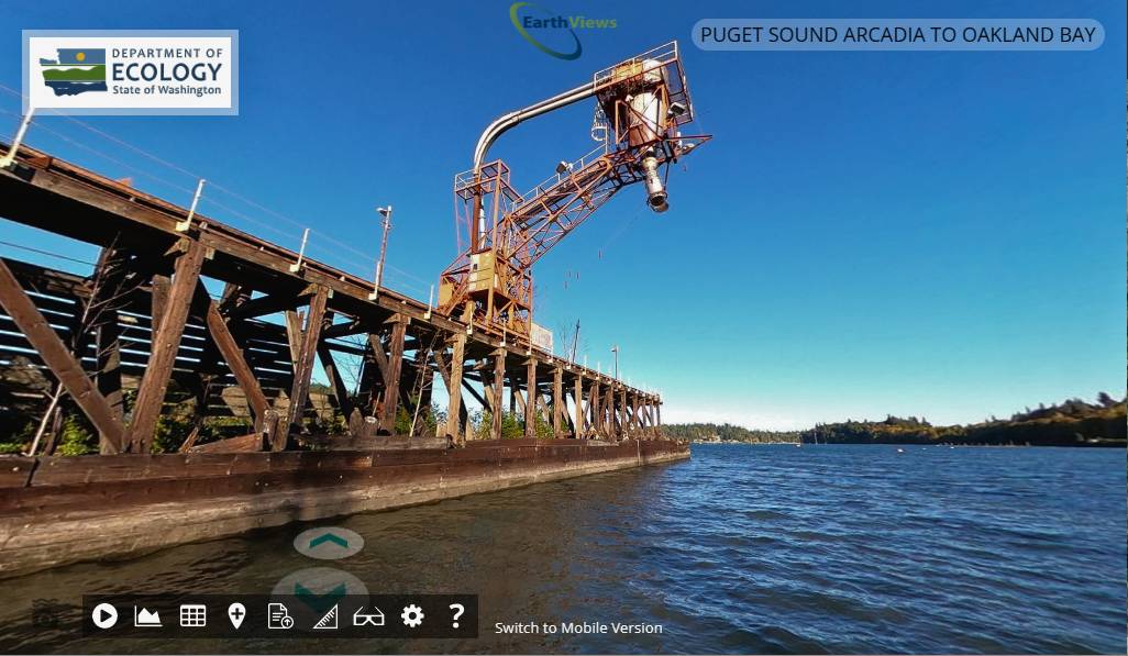
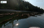
Shelton Lumber Mill
Shelton Lumber Mill
An industrial landmark, the Shelton Lumber Mill represents the historical and ongoing significance of the timber industry in the region.
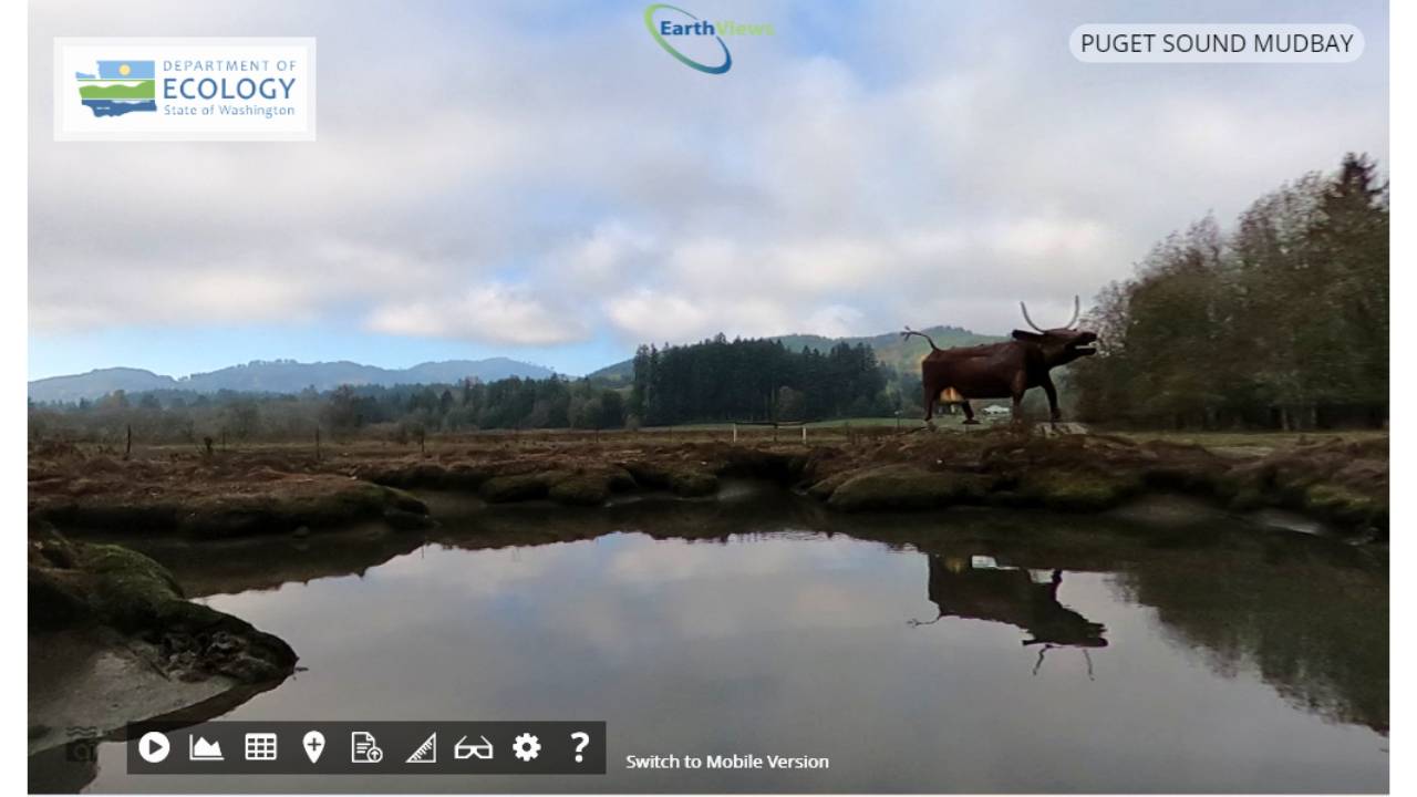
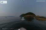
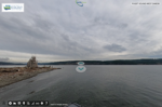
Mud Bay
Mud Bay
A historic and ecologically rich estuary in Puget Sound, Mud Bay is noted for being the meeting place of explorer Peter Puget and the Squaxin Island tribe during the Vancouver Expedition.
Mid Sound
Nisqually Wildlife Refuge
Nisqually Wildlife Refuge
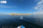
Billy Frank Jr. Nisqually National Wildlife Refuge is a remarkable example of estuary restoration, transforming former farmland into a thriving wetland that supports salmon recovery and migratory birds. Managed by the U.S. Fish and Wildlife Service in collaboration with the Nisqually Tribe, the refuge is a protected area where recreational boating is off-limits to preserve its delicate ecosystem. Read more
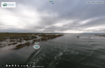
Nisqually River Mouth
Nisqually River Mouth
Derelict Tug at the Mouth of the Nisqually River serves as an unexpected wildlife perch in an area where natural snags have become scarce. When mapped, a bald eagle was seen using the weathered vessel as a vantage point, a testament to how nature adapts to changing landscapes. Read more
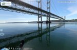
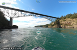
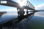
Narrows Bridge
Narrows Bridge
Tacoma Narrows Bridge and Passage is a dynamic waterway where all the tidal flow from South Puget Sound funnels through, creating powerful currents beneath the iconic twin spans. Below the surface, thriving kelp forests provide critical habitat, sheltering marine life, including the world’s largest octopuses—the legendary Giant Pacific Octopus. Read more
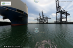
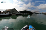
Port of Tacoma
Port of Tacoma
Port of Tacoma is one of the largest and busiest ports on the West Coast, a critical gateway for international trade. Nestled on Commencement Bay, its deep-water harbors serve massive container ships and industry, yet the surrounding waterways remain essential for salmon migration and marine ecosystems. Read more
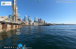
Seattle Waterfront
Seattle Waterfront
Seattle Waterfront underwent a major overhaul, transforming its aging infrastructure while incorporating habitat-friendly design. The redevelopment included structures to support migrating salmon, such as light-penetrating surfaces and restored shoreline features. Once a heavily industrialized waterfront, the area now blends urban vibrancy with ecological improvements, enhancing both public access and marine life habitat. Read more
Blake Island
Blake Island
Blake Island is an important to the Suquamish Tribe and is believed to be the birthplace of Chief Seattle. The island, now a state park, has long been a place of cultural significance. For many years, the Suquamish Tribe partnered in hosting traditional-style potlatch experiences at Tillicum Village, sharing Coast Salish traditions, storytelling, and salmon-bake feasts with visitors. Read more
North Sound
Deception Pass
Deception Pass
Deception Pass is a breathtaking and rugged waterway known for its swirling currents, dramatic cliffs, and the iconic Deception Pass Bridge connecting Whidbey and Fidalgo Islands. Named by early explorers who were misled by its complex channels, the pass is a gateway between Puget Sound and the Strait of Juan de Fuca. Beneath the churning waters, rich marine life thrives, including kelp forests and schools of migrating salmon. The surrounding state park, Washington’s most visited, offers stunning coastal views and a glimpse into the region’s deep Indigenous history. Read more
La Conner
La Conner
La Conner is a charming waterfront town nestled along the Swinomish Channel, known for its vibrant arts scene, historic buildings, and tulip-filled spring landscapes. Once a bustling fishing and trading hub, it remains deeply connected to the Swinomish Tribe, whose nearby reservation and cultural heritage shape the area. Today, La Conner blends small-town charm with a thriving maritime and artistic community. Read more
Skagit Bay
Skagit Bay
Skagit Bay is where the Skagit River meets the Salish Sea, creating a vast network of estuaries, mudflats, and eelgrass beds that support salmon, shellfish, and migratory birds. This vital ecosystem has been stewarded for generations by the Swinomish Indian Tribal Community, Sauk-Suiattle Tribe, Upper Skagit Tribe, and Samish Indian Nation, who continue to lead conservation and habitat restoration efforts. Read more
Bellingham Bay
Bellingham Bay
Bellingham Bay & Nooksack Estuary form a dynamic coastal ecosystem where the Nooksack River meets the Salish Sea. Vital for salmon and migratory birds, the estuary supports rich tidal marshes, while Bellingham Bay reflects the region’s balance between industry, recreation, and restoration efforts. The Lummi Nation and Nooksack Tribe have long stewarded these waters, working to protect fisheries and revitalize critical habitats. Read more
Lummi Island
Lummi Island
Lummi Island lies at the heart of the Lummi Nation’s ancestral territory, offering rugged shorelines, dense forests, and rich marine waters. Known for its sustainable reef-net fishing tradition, the island remains vital to tribal fisheries and Salish Sea conservation efforts. Its quiet, scenic beauty contrasts with the powerful currents that shape its shores. Read more
Canadian Border
Canadian Border
Point Roberts Boundary Monument marks the easternmost land border between the U.S. and Canada on this unique peninsula, accessible only by land through Canada. A quiet yet symbolic spot, it represents one of the most unusual geopolitical divisions in North America. Overlooking the Salish Sea, the marker stands near waters rich with marine life, including migratory salmon and passing orcas, highlighting the region’s ecological and cultural significance. Read more
Hood Canal
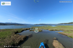
Union Estuary
Union Estuary
The Union River Estuary has long been significant to the Belfair area, both culturally and economically. For the Skokomish Tribe, the estuary was an important traditional fishing and shellfish harvesting site, providing clams, oysters, and salmon for generations. The river also played a role in early logging history, as timber from the surrounding forests was floated downriver to Hood Canal for transport. Read more
Skokomish Estuary
Skokomish Estuary
Skokomish Estuary is one of the largest restored estuaries in Hood Canal, reclaimed after decades of diking and drainage. Once a rich tidal marsh, the area was reconnected to the canal, allowing salmon, shellfish, and migratory birds to return in abundance. The Skokomish Tribe has led these restoration efforts, reviving traditional fishing and shellfish harvesting while restoring the estuary’s natural role in filtering water and supporting marine ecosystems. Read more
Hamma Hamma Estuary
Hamma Hamma Estuary
Hamma Hamma is a tidal estuary along Hood Canal, renowned for its pristine oyster beds and shellfish farming. The Skokomish Tribe, who have stewarded these waters for generations, continue to harvest oysters and clams here, maintaining deep cultural and economic ties to the region. Fed by a cold, clear river, the estuary provides ideal conditions for shellfish, supporting both tribal and commercial aquaculture in one of Puget Sound’s most productive growing areas. Read more
Dabob Broad Spit
Dabob Broad Spit
Dabob Broad Spit is a remote sandspit extending into Dabob Bay, shaping a protected marine ecosystem within Hood Canal. Its nutrient-rich waters support eelgrass beds, shellfish, and forage fish, making it a key nursery for marine life. The area is also adjacent to Naval testing ranges, where the U.S. military conducts underwater research and submarine acoustic testing in the deep, quiet waters of Dabob Bay. Read more
Tarboo Bay
Tarboo Bay
Tarboo Bay is a sheltered inlet off Hood Canal, known for its thriving salt marshes and rich shellfish beds. Historically stewarded by the Jamestown S’Klallam and Lower Elwha Klallam Tribes, the bay supports vital eelgrass habitat for salmon, Dungeness crab, and migratory birds. Ongoing restoration efforts focus on preserving its delicate estuarine ecosystem, ensuring it remains a haven for wildlife and sustainable shellfish harvesting. Read more
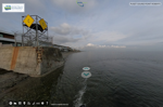
Hood Canal Bridge
Hood Canal Bridge
Hood Canal Bridge is the world’s longest floating bridge over saltwater, famously sinking in a 1979 storm before being rebuilt. It also serves as a critical passage for Bangor-based nuclear submarines, which transit beneath its spans as they move between Hood Canal and the Pacific. Read more
Strait of Juan de Fuca
Smith Island
Smith Island
Smith Island rises from the Strait of Juan de Fuca as a remote, windswept outpost, serving as a critical haul-out site for thousands of harbor seals. The island’s rugged shores and shifting sandbars provide prime habitat for marine mammals and seabirds, while strong currents make its surrounding waters rich with marine life. Once home to a lighthouse guiding ships through treacherous waters, Smith Island now stands as a wild and largely undisturbed sanctuary. Read more
Fort Warden Lighthouse
Fort Warden Lighthouse
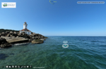
Fort Worden Lighthouse stands at the entrance to Puget Sound, guiding vessels through the often-foggy waters of the Strait of Juan de Fuca. Once part of a strategic military defense system, the fort protected the inland waters from potential naval threats. Today, the lighthouse remains an iconic landmark, overlooking strong tidal currents and some of the richest marine ecosystems in the Pacific Northwest. Read more
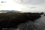
Dungeness Spit
Dungeness Spit
Dungeness Spit stretches over five miles into the Strait of Juan de Fuca, making it one of the longest natural sand spits in the world. Constantly shaped by wind and tides, it shelters a rich estuarine ecosystem vital for shorebirds, seals, and salmon. At its tip, the historic New Dungeness Lighthouse has guided mariners since 1857, standing as a symbol of the region’s deep maritime history. Read more
Elwha River
Elwha River
Elwha River Estuary is a testament to one of the most ambitious dam removal projects in history. After the Elwha and Glines Canyon Dams were taken down, the river once again carried sediment to the estuary, rebuilding lost habitat and expanding vital wetlands. Salmon runs have rebounded, feeding eagles, otters, and orcas, while native vegetation reclaims the shoreline. The estuary now stands as a living example of how ecosystems can recover when given the chance. Read more
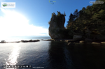
The Towers
The Towers
The Towers are massive sea stacks rising from the Strait of Juan de Fuca, just east of Neah Bay. These rugged rock formations, shaped by relentless ocean waves, provide critical nesting sites for seabirds and perches for bald eagles. Long revered by the Makah Tribe, they stand as ancient sentinels of the coastline, watching over one of the most powerful and untamed stretches of the Pacific Northwest. Read more
Makah Neah Bay
Makah Neah Bay
Neah Bay is the homeland of the Makah Tribe, who have thrived along this rugged coastline since time immemorial. Overlooking the entrance to the Strait of Juan de Fuca, the bay has long been a center for fishing, whaling, and maritime trade. Today, it remains a vital hub of Makah culture and heritage, with the Makah Museum preserving ancient artifacts, including those from the Ozette archaeological site. The waters off Neah Bay are rich with marine life, where powerful currents and rocky shores shape one of the wildest seascapes in the Pacific Northwest. Read more
San Juan Islands
Lopez Watmough Bay
Lopez Watmough Bay
Lopez Island – Watmough Bay is a secluded gem on the island’s southeast shore, framed by towering cliffs and pristine shoreline. Protected waters and rich eelgrass beds make it a haven for marine life, while the surrounding forests provide habitat for eagles and other wildlife. A cherished spot for quiet recreation, Watmough Bay offers stunning views of the Salish Sea and remains an important natural and cultural site in the San Juan Islands. Read more
Orcas North Shore
Orcas North Shore
Orcas Island North Shore is a rugged coastline where vast kelp forests sway in the strong currents of the Salish Sea. These rich underwater habitats provide shelter for fish, feeding grounds for seabirds, and critical refuge for marine life, including juvenile salmon. The kelp beds also play a key role in carbon sequestration, stabilizing the shoreline while supporting the delicate balance of this dynamic ecosystem. Read more
Sucia Islands
Sucia Islands
Sucia Islands are a remote, rocky archipelago in the San Juan Islands, known for their sculpted sandstone formations, hidden coves, and rich marine life. Once a smuggler’s haven, these protected waters now serve as a sanctuary for boaters, kayakers, and wildlife. Tide pools and kelp forests thrive along the shores, while fossilized remnants in the cliffs reveal glimpses of the region’s prehistoric past. Read more
Patos Island
Patos Island
Patos Island, the northernmost of the San Juan Islands, is a remote and windswept outpost where strong currents and rocky shores shape the landscape. Home to the historic Patos Island Lighthouse, it has long guided mariners through the treacherous waters of the Strait of Georgia. The island’s rugged beauty and isolation make it a haven for seabirds, seals, and those seeking solitude on the edge of the Salish Sea. Read more
Spieden Island
Spieden Island
Spieden Island stands out in the San Juan Islands with its unique history as a former exotic game hunting preserve. In the 1970s, mouflon sheep, fallow deer, and Sika deer were introduced, and their wild descendants still roam the island’s grassy slopes today. Though privately owned and off-limits to visitors, Spieden’s stark contrast between its lush north side and arid south side makes it one of the most distinctive landscapes in the Salish Sea. Read more
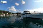
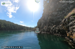
San Juan Roche Harbor
San Juan Roche Harbor
Roche Harbor on San Juan Island is a historic seaside village known for its luxury yachts, upscale residences, and one of the highest per capita wealth levels in the nation. Once the site of the Pacific Northwest’s largest lime works, its limestone quarries and kilns fueled regional industry in the late 19th century. Today, remnants of this past remain alongside a world-class marina, boutique shops, and the iconic Hotel de Haro, blending history with modern-day elegance. Read more